Highborne Cay, Exumas
Current Position:
N 24 43.1
W 076 49.9
We left Rum Cay on Thursday April 26th around 1pm. The weather forecast was for east winds 15-17 knots on Thursday and 15 knots on Friday. Perfect for a run straight across the Exuma Sound to Highborne Cay in the northern Exumas, 125 miles. The annoying thing about weather forecasts is that they are never exact and they are often wrong. We kept hoping that the light winds would build; maybe the 4-8 knots of wind was a temporary lull. We flew the spinnaker and started making better time and determined to keep it up into the moon-lit night, especially when the winds did pick up to 11-14 knots apparent around midnight. We were flying then! 6… 7… 8… 9 knots of speed! Hmmmm…. was it now blowing too hard to get the spinnaker down??? Crew meeting determined that the higher winds were just temporary gusts and there was a pattern of moderation in between that warrented keeping the spinnaker up through the night. 3:30am: Foreguy (control line for spinnaker pole) chafed through and POW! Broken line. Fortunately, Capt’n Rod had the foresight to rig a backup tack line to the bow so at least the spinnaker didn’t fly free at this moment. But the lighter duty backup line wouldn’t last long so we decided to get the spinnaker down in the last hour of moonlight.
By 7am Friday morning all gusts, puffs, gentle breezes, and whispers of winds had completely dissapeared. Sails flogging, optimism waning. Where were the 15 knots of wind? To our dismay, we had to call on Forrest.
At 4pm (Friday) we were entering the Highborne Cut to cross through from the Exuma Sound to the Exuma Bank on the west side of Highborne Cay in the northern Exumas. By 4:30 we were dropping the hook in almost exactly the same spot we had anchored just over a year ago. This is where we had our first happy hour with Greg and Cindy on Day Dreamer and started a great friendship!
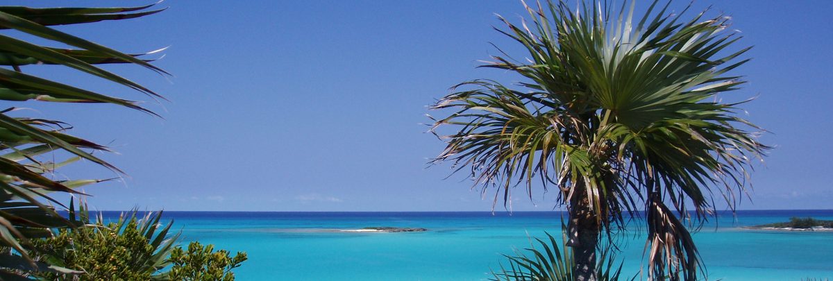
Since leaving the Bahamas a year ago we have often reflected back on the beauty of its waters; the clarity, the amazing turquoise color, the wonderful sandy anchorages and beaches. You know how sometimes memories become more favorable as time passes and our minds eye can paint a more pleasant picture than reality? Well, this was a case of the opposite. It was more breathtaking than either of us had recalled. 24 feet of water under us and it looked like a wading pool. Blades of grass, rocks, barracuda, all perfectly visible.
From here we plan to travel 30 miles to Rose Island which is a neighbor to the more well-known island of New Providence (home of Nassau). Conditions today (Saturday, April 28) are cloudy and we will probably encounter a bit of rain from a passing front. We hope it will at least provide enough wind to get us to our destination. Forecast is for light winds from the southeast to south. Will today’s forecast be accurate?